


Hibiya: Tokyo's navel
In the 2nd article of our new 'Transcreating Tokyo' series, Takeo Funabiki navigates the city's anatomy
Discover more of Japan with UnionPay

100 best shops in Tokyo

Most viewed
Most recent blogs

Style of the Day


Recent features / venues
- Things to do this week in Tokyo
- 50 things to do in Sapporo
- Top five club gigs in Tokyo this weekend
- Photo of the day: Koenji Awa-Odori
- Things to do this week in Tokyo
- Tokyo's top 10 animal cafés
- The rise of the virtual pop star
- Top five club gigs in Tokyo this weekend
- Things to do this week in Tokyo
- Top five club gigs in Tokyo this weekend
Connect with us

Posted: Sat Feb 01 2014
Tokyo's basic topography has not changed much over the last 400 years. In order to understand it, you need only know that Tokyo is built on three main types of land: the ‘landfill’ bordering the sea, the ‘lowland’ between the rivers, and the ‘plateau’ that spreads inland. One area, the southeastern corner of the Imperial Palace at Hibiya, overlooks all three types.

The landfill
In pre-Edo days, the area south of the Hibiya intersection was an ocean cove, but today long streets lined with tall buildings span the distance between Hibiya and the present-day coastline at Hama-Rikyu and its vicinity. All of this was constructed on landfill that replaced what had previously been riverlands and the sea. Before Edo existed, however, most of the terrain near the seashore was very rough, disrupted by countless small hills and depressions. At the start of Hibiya-dori, close to where this uneven coastline used to be, stands what was once the tallest peak within Tokyo's 23 wards, Mt Atago (boasting an impressive elevation of 25.7 metres!). Massive public works were undertaken to flatten the hillocks during the construction of Edo, whereas the dips were in turn filled in with soil dug up during the building of Edo Castle’s moat. These efforts allowed for the expansion of the city and its population, and led to the building of the Hibiya, Marunouchi, Yaesu, Nihonbashi, Kyobashi, Shinbashi and Tsukiji districts.
As a result of this, water-related place names that include the characters for ‘valley’ (as in Hibiya), ‘sandbank’ (in Yaesu), and ‘bridge’ (in the -‘bashi’ names) remain in the area, despite the fact that the water is long gone. The most obvious one is ‘Tsukiji’ (famous for its fish market), which simply means ‘landfill’. Later, especially after the destructive 1657 Meireki-era citywide fire, Edo was re-envisioned as a more expansive, safe and vibrant city. The sea coast was filled in and rivers were re-routed, expanding the urban area of Edo eastward from the Sumida river all the way to the Fukagawa district in today's Koto Ward. The basic topography of the densely populated city did not change even after Edo was renamed Tokyo, and as the city now continues to grow, the Koto landfill is being envisioned as the site for a new waterfront city centre and facilities for the upcoming Olympics.
The lowland
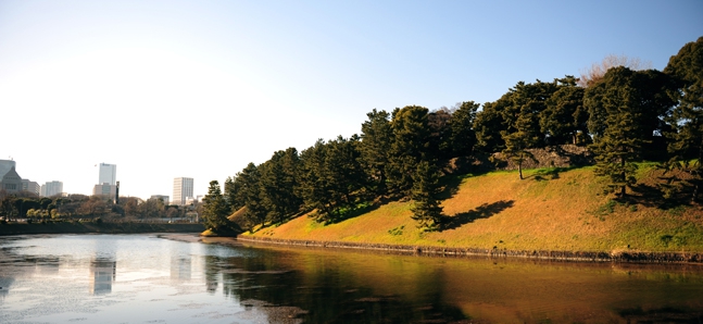
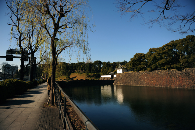
If one looks to the north from Hibiya, the Imperial Palace, with its moat and stone walls, appears to the left. The wall's abrupt rise from the water hints at this area’s origins as a lowland near an ocean cove. To the east of the moat and Hibiya-dori are the areas of Yurakucho and Ginza, and to their east and north is lowland, which rises only a few metres above sea level. This general area was once the delta of the Sumida and Tone rivers, a place where coves and wetlands predominated before the landfill works described above were initiated. This flatland continues east all the way to Chiba Prefecture.
The plateau
Now, turning westward and looking past the Imperial Palace, you should notice the Sakurada Gate, and beyond that, the Sakurada moat. As can be seen from the photo of the Imperial Palace in part one of this column series, the water level of the Sakurada moat is ten metres higher than that of the Hibiya moat, while a grass-covered slope rising up from the Sakurada moat leads to the stone wall. This difference is due to the fact that this moat was built on a slightly elevated plateau – if you turn your eyes to the Imperial Palace’s Fukiage Garden from the National Theatre side of the moat, you will notice that the garden and the moat sit on the same level, which was once a gently descending slope. This means that the Sakurada Gate was at the boundary of the vast Musashino plateau, which reaches in from the west, and the pre-Edo lowland area to the east. As I mentioned in the first column, the Imperial Palace area came to incorporate the original nature that existed before Edo – the background to this becomes clear when one begins to understand this topography.
The city's navel
Thus, Edo Castle, and even the pre-Edo castle built by 15th-century samurai Ota Dokan, both of which once stood where the Imperial Palace is now, were positioned at a navel-like meeting point of cove, lowland and plateau. The location of Ota’s castle (Hirayama Castle) was, of course, very deliberately chosen, as it was placed on a small rise on the edge of the plateau, strategically overlooking the lowlands on which the ruler’s subjects lived. Later, the 'daimyo' lords (military leaders) and their bannermen were housed around Edo Castle and on the plateau on its western side, an area which came to be known as the ‘uptown’ (Yamanote), while the eastern lowland was filled in, forming the ‘downtown’ where townspeople resided. From an urban planning perspective, this was very neat and orderly indeed.
...And the Achilles' heel
However, one of Edo's weaknesses was, surprisingly enough, water. Water seemed to be everywhere in the landscape of Edo. The problem was that this water was sea water, which mixed with groundwater and made wells saline. Fresh water therefore had to be brought to the city from the inner regions of the plateau, led from places like the Tama River and Inokashira Pond through sloping conduits built from stone and wood. Building the conduits was said to have been a mighty struggle. When writing of how water was brought down into town from the outskirts of Edo and then routed through underground conduits to the lodgings of samurai and townspeople, I cannot help but notice the resemblance to today's commuters, converging into the city on subway cars from the suburbs every morning. How similar the topography of modern Tokyo is to that of ancient Edo.
Takeo Funabiki
Cultural anthropologist
1948, born in Tokyo
1972, BA, University of Tokyo, Faculty of Liberal Arts
1982, PhD in anthropology, Cambridge University, Graduate School of Social Anthropology
1983, University of Tokyo, College of Arts and Sciences, lecturer
1994, Professor
1996, University of Tokyo, Graduate School of Arts and Sciences, professor
2012, retired from the Graduate School, Professor Emeritus
Field work conducted in Hawaii, Tahiti, Japan (Yamagata Shonaiheiya), East Asia (China, Korea) and Melanesia/Polynesia (Vanuatu, Papua New Guinea). Professional interests include 1) mechanism of mutual interference of human culture and nature, 2) the representations of ritual and theatre, and 3) changes in culture and society that occur during the course of modernisation.
Related articles
Transcreating Tokyo
Cultural anthropologist Takeo Funabiki puts the city's layered eras into perspective
The body of Edo
In part 3 of our 'Transcreating Tokyo' series, Takeo Funabiki explores the history of the ...
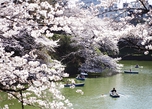
The cherry blossoms of Edo
In part 4 of our 'Transcreating Tokyo' series, Takeo Funabiki surveys the sakura
Tweets
- About Us |
- Work for Time Out |
- Send us info |
- Advertising |
- Mobile edition |
- Terms & Conditions |
- Privacy policy |
- Contact Us
Copyright © 2014 Time Out Tokyo
Add your comment