Best day and weekend hikes
Living in crammed Tokyo, it’s easy to forget that 70 percent of Japan is made of mountains. Nick Narigon celebrates the announcement of a new ‘mountain holiday’ with his pick of the best trails
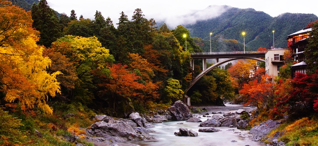
Okutama Valley. © 3x/Pixta
Posted: 月 10 20 2014
From 2016, Japan will inaugurate an annual August 11 Mountain Day public holiday. Good news for overworked salarymen who might just need a lie in, but the government hopes the day off will encourage people to ‘get familiar with mountains and appreciate blessings from mountains’. Well, we don’t need any more encouragement, so we immediately set to work scouting out the most beautiful trails around Japan, giving them a star rating out of five for difficulty level. Although Mountain Day is set for summer, the prime season for hiking is autumn, when foliage is a work of art and views are pristine.
Easy day hikes
MT JINBA (855m)
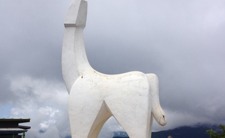
Photo by: Nick Narigon
Mt Takao (599m) has multiple courses suitable for all ages and fitness levels. But you knew that already – Takao is the most heavily trafficked mountain in the world. For a different route, head down the road to Mt Jinba, famed for the somewhat phallic white statue (it’s meant to be a horse) at the summit. The 18.5km (total) route ends at Takao and the flat traverse along the ridge can be completed in about six hours.
Difficulty level ★★
How to get there From Shinjuku Station, take the Keio or Chuo line to Takao Station, then hop on the bus towards Jinba Kogenshita and get off at the last stop. More info
MT OTAKE (1,266.5m)
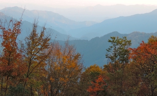
Photo by: Nick Narigon
The Musashi-Mitake Shrine at the summit of Mt Mitake (929m) has been a centre of worship for over 2,000 years. It is also the starting point for the hike to Mt Otake (sometimes spelt Odake), the tallest mountain in Tokyo Prefecture. From the shrine, it’s a two- or three-hour semi-strenuous trek through the natural rock garden, a stretch of moss-covered rocks, and past Ayahiro Falls. The summit isn’t astounding, but does offer the obligatory view of Fuji.
Difficulty level ★★
How to get there From Shinjuku Station, take the Chuo line to Ome Station, then take the Ome line to Mitake Station. More info
MT KAWANORI (1,363m)
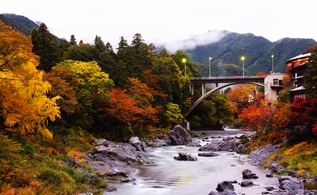
Overlooking the picturesque river valley of Okutama, Mt Kawanori’s main attraction is the scenic Hyakuhiro Falls. In summer this hike is somewhat pedestrian, but autumn and winter provide serenity and gorgeous views of the snow and ice. It takes three-and-a-half hours to reach the summit, with some challenging climbs and descents. Add three hours to reach Hatonosu Station, for a total hike of 14km, and roughly seven hours.
Difficulty level ★★★
How to get there From Shinjuku Station, take the Chuo line’s express train to Okutama Station, then take a local bus from stand no. 1 to Kawanoribashi. More info
MT TSUKUBA (877m)
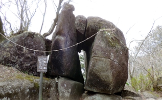
Photo by: Nick Narigon
At the centre of Ibaraki Prefecture, Mt Tsukuba (877m) is notable for its ‘power spots’ including an 800-year-old Japanese cedar tree (Shihosugi) and various rock formations. Along the trail, one pile of boulders depicts two ships passing in the sea, while another portrays a frog with an open mouth. Follow one of two three-hour round-trip courses: the winding 2.8km Shirakumobashi course or the steep 2.5km Miyukigahara course.
Difficulty level ★★
How to get there From Asakusa Station, take the Tsukuba Express to Tsukuba Station, then take the Tsukuba shuttle bus to Tsukubasan Jinja Iriguchi. More info
MT MITSUTOGE (1,785m)
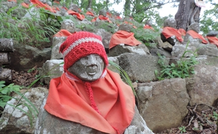
Photo by: Nick Narigon
The well-marked trail from Mitsutoge Station to Mt Mitsutoge offers a bit of variety, comfortably combining steep climbs, switchbacks and bridges. Near the top you’ll pass the ‘88 Buddhas’ (there are only 81 remaining) dressed in red, and the popular rock-climbing wall. There are splendid views of Fuji the entire 15km, six-hour trip, and the descent is a rolling path overlooking Lake Kawaguchi.
Difficulty level ★★ ½
How to get there From Shinjuku Station, take the Chuo line to Otsuki Station, then hop on the Fujikyuko line to Mitsutoge Station. More info
Double-day hikes
MT OKU-SHIRANE (2,578m)
Kanaya Hotel
Also known as Nikko-Shirane, this is the highest peak in Nikko National Park. A 15km loop winds its way up the mountain range, allowing hikers to peek not only Oku-Shirane, but also Mt Mae-Shirane (2,373m) and Mt Goshiki (2,379m). The trip can easily be turned into an overnighter, with several other nearby mountains to explore.
Difficulty level ★★★
How to get there From Asakusa Station, take the Tobu-Nikko line to Tobu Nikko Station, then take the bus to the last stop at Yumoto Onsen.
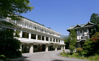
Where to stay Nikko Kanaya Hotel. 1300 Kamihatsuishi-machi, Nikko, Tochigi. 0288 540001. More info
MT AKA-DAKE (2,899m)
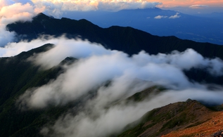
Photo by: Shinji/Pixta
The highest peak in the South Alps’ Yatsugatake (‘eight peaks’) region. Starting from Minotoguchi, it takes about three hours to reach Akadake Kosen Lodge. The next day is a two-and-a-half-hour stretch to the summit, which offers views of Mt Fuji and the Southern, Central and Northern Alps. Experienced hikers can complete this trip in winter with an ice axe and crampons.
Difficulty level ★★★
How to get there From Shinjuku Station, take the Chuo line’s Azusa limited express train to Chino Station, then take a local bus to the last stop at Minotoguchi. More info
Where to stay Akadake Kosen Lodge. For reservations, call 090 4824 9986 or e-mail akadake@alles.or.jp (Japanese only). More info
TANZAWA MOUNTAIN RANGE (1,673m)
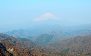
Photo by: Nick Narigon
The rugged web of trails in Kanagawa Prefecture rise above the tree line, providing a panoramic view of Fuji’s foothills. For a two-day trip, start from Okura and hike 8.9km to the top of Mt Tonodake (1,491m). After an overnight stay, day two features 20km of knee-knocking descents and steep uphill climbs over Mt Tanzawa (1,567m), Mt Hirugatake (the highest point in the Tanzawa mountain range), and Mt Hinokiboramaru (1,601m).
Difficulty level ★★★★
How to get there From Shinjuku Station, take the Odakyu Odawara express to Shibusawa Station, then take the bus to Okura. Return from Nishi-Tanzawa Shizen Kyoshitsu bus stop.
Where to stay There are several mountain huts that offer futon beds and light meals. We recommend Sonbutsu Sanso on Mt Tonodake. For reservations, call 090 2569 6013 or e-mail sonbutsusanso@yahoo.co.jp. More info (Japanese only)
MT YAKE-DAKE (2,455m)
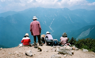
Photo by: Bjorn Houtman
This is the North Alps’ most active volcano. From Kamikochi, the three- to four-hour hike starts off moderate until you climb two ladders bolted to the cliff face. From there you are in alpine country, and open to wildlife encounters including bears. Near the peak it’s a steep scramble through volcanic rock, but the summit is one of the best lunch spots in Japan, complete with 300m-wide crater and geothermal vents.
Difficulty level ★★★★
How to get there From Shinjuku Station, take the Chuo line’s limited express Azusa train to Matsumoto Station, then take a taxi to Kamikochi. Note that Kamikochi is closed off during winter – from around Nov 15. More info
Where to stay Nishi-Itoya Mountain Lodge in Kamikochi. 0263 95 2206. More info
MT KITA-DAKE (3,193m)
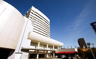
Rest weary legs at Kofu Fujiya Hotel
Japan’s second tallest mountain, Kita-dake is part of the Southern Alps mountain range and is comparable to climbing Fuji. From the parking lot at Hirogawara, go across the pedestrian bridge. After 20 minutes, you’ll reach a fork – take the trail to the right, which gets steep quickly. The seven kilometer hike ends five to six hours later at the Katanokoya lodge where there’s also a campground. On day two it is a 45-minute hike to the summit for sunrise. Ambitious hikers can keep going to Mt Aino-dake (3,189m), Japan’s fourth highest mountain.
Difficulty level ★★★★★
How to get there From Shinjuku Station, take the Chuo line’s limited express Azusa train to Kofu Station, then take a two-hour bus ride to Hirogawara. More info
Where to stay Katanokoya on Mt Kita-dake. For reservations, call 055 288 2421. More info (Japanese only).
To stay overnight before or after your hike, check out Kofu Fujiya Hotel. 3-2-30 Yumura, Kofu, Yamanashi. 055 253 8111. More info
This article appears in the autumn 2014 issue of Time Out Tokyo magazine. Get your copy here

Tags:
Tweets
- About Us |
- Work for Time Out |
- Send us info |
- Advertising |
- Mobile edition |
- Terms & Conditions |
- Privacy policy |
- Contact Us
Copyright © 2014 Time Out Tokyo



Add your comment